



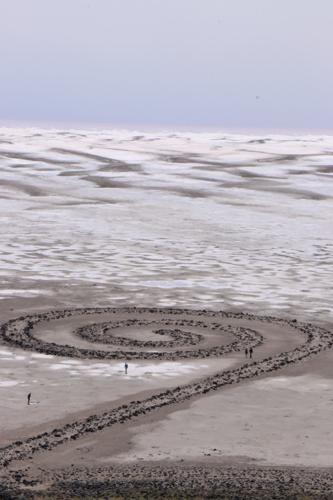


The Spiral Jetty remained submerged under the surface of the Great Salt Lake and out of sight for more than 20 years not long after it was built in 1970.
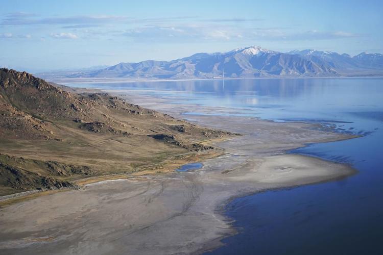
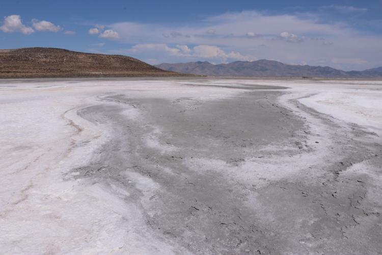
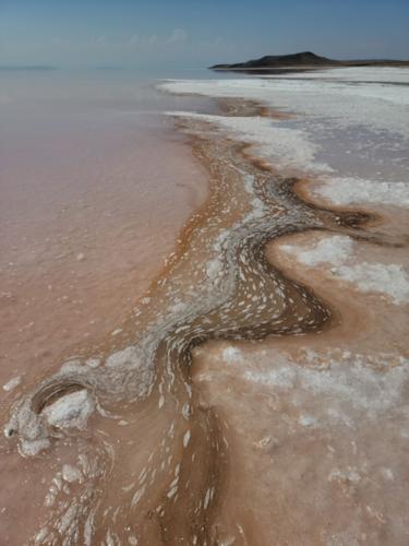
Today, the popular work of outdoor art stretching into a remote bay in Box Elder County sits several hundred yards from the receding shoreline, with a 10 to 15 minute walk required from the Spiral Jetty to the water’s edge. The dark volcanic rocks that make up the jetty stand out in stark contrast to the surrounding dry lakebed encrusted with salt and other minerals left behind by evaporating water.
The jetty serves no practical purpose, and continues to see a steady flow of visitors. But its present-day position far from the lake itself is one of the most visible reminders that the water levels at the Great Salt Lake have hit a historic low, a grim milestone for the largest natural lake west of the Mississippi River that comes as a mega-drought grips the region.
The U.S. Geological Survey recently announced average daily water levels had dropped about an inch below the previous record of 4,191.4 feet, which was set in 1963.
The new record comes months earlier than when the lake typically hits its lowest level of the year, indicating water levels could continue to drop even further, said Candice Hasenyager, the deputy director of Utah’s Division of Water Resources.

Exposed lakebed now stretches several hundred yards past the Spiral Jetty along the shore of the Great Salt Lake in Box Elder County. The lake level dropped to a new low in October 2021 and is expected to fall farther this year. The Spiral Jetty was submerged under the lake’s surface for most of the 1970s, ‘80s and ‘90s.
At the historic average surface elevation of 4,200 feet the lake covers an area of about 1,700 square miles. At the previous historic low elevation of 4,191.35 in 1963, the lake covered only 950 square miles. The drop of about 8.5 feet in elevation resulted in a loss of about 44 percent in surface area.
At historic highs during 1986 and again in 1987, the lake reached an elevation of 4,211.6 feet and had a surface area of about 3,300 square miles.
Great Salt Lake differs in elevation between the south and north parts. The Union Pacific Railroad causeway divides the lake into two parts. The water-surface elevation of the south part of the lake is usually higher than that of the north part because most of the inflow to the lake is in the south part.
Therefore, two gages are used to monitor the different lake levels. The gage at the boat harbor at Saltair Beach State Park measures the elevation of the water in the south part. It has been operated since October 1938. The gage at the Little Valley Boat Harbor, northwest of Saline, Utah measures the elevation of the water in the north part. It has been operated since April 1966. A third gage was operated at Promontory Point (north end of the south part) from October 1986 to September 1999.
Receding waters are already affecting a nesting spot for pelicans, which are among the millions of birds dependent on the lake. Gunnison Island, a remote area in the Box Elder County portion of the lake, is home to one of the largest populations of American white pelicans.
Biologists estimate that between 10 and 20 percent of all American white pelicans live on Gunnison Island, which has historically offered protection from predators due to its isolation from the mainland. However, the shrinking of the lake has exposed a land bridge, giving coyotes and other predators a way to reach the island and access the ground-level nests of pelicans and other birds.
Sailboats have been hoisted out of the water to keep them from getting stuck in the mud. More dry lakebed getting exposed could send arsenic-laced dust into the air that millions breathe.
People for years have been diverting water from rivers that flow into the lake to water crops and supply homes. Because the lake is shallow — about 35 feet at its deepest point — less water quickly translates to receding shorelines.
Most years, the Great Salt Lake gains up to 2 feet from spring runoff. This year, it was just 6 inches.
The drought is drying up lakes across the West and worsening massive wildfires affecting California and Oregon. Utah Gov. Spencer Cox, a Republican, has begged people to cut back on lawn watering and “pray for rain.”
Extreme conditions like these are often from a combination of unusual random, short-term and natural weather patterns heightened by long-term, human-caused climate change.
Scientists have long warned that the weather will get wilder as the world warms, and climate change has made the West much warmer and drier in the past 30 years.

(0) comments
Welcome to the discussion.
Log In