

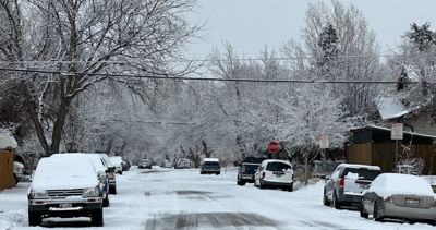
The winter storm that arrived in East Idaho on Wednesday evening is forecast to continue bearing down on much of the region through Thursday afternoon.
The National Weather Service has issued winter weather advisories for East Idaho warning the public about the potentially hazardous driving conditions caused by the storm.
The areas forecast to be hardest hit by the storm Thursday morning and afternoon are Almo, Albion and Emigration Summit, all of which are expected to receive up to 6 inches of snow.
Up to 3 or 4 inches of snow are forecast to fall during that same time frame in the Blackfoot, Shelley, Firth, Fort Hall, Aberdeen, American Falls, Pocatello, Chubbuck, Inkom, Preston, McCammon, Arimo, Downey, Malad, Arbon, Rockland, Lava Hot Springs, Thatcher, Malta and Holbrook areas.
Other areas of East Idaho are expected to receive only small amounts of snow if any on Thursday before the storm exits the region.
Winds of up to 25 mph will accompany Thursday's snowfall, making for even more difficult driving conditions, especially in the highlands.
Stay with idahostatejournal.com for the latest weather forecast updates.

(0) comments
Welcome to the discussion.
Log In