

In its three-month outlook for December 2018 and January and February 2019, the National Weather Service predicted it will be a warm winter for much of the United States, including Idaho.
However, National Weather Service meteorologist John Keyes said the outlook should be considered a “general pattern,” explaining it’s difficult to tell exactly what winter is going to look like in the state.
“These outlooks don’t take into account individual storms or shorter time periods in the winter itself,” Keyes said. “We can have a good chunk of winter that has snow even at the really low elevations, then we get a really warm period that counters that and would end up pushing it more toward the trend of a warmer than normal winter here.”
Keyes said if the pattern does hold, though, it is likely that the state’s lower elevations will receive less snow and more rain during the winter months.
The national report also predicted that parts of Idaho will have a drier than normal winter. Keyes said conditions favor dry weather in the Island Park, Stanley, Challis and surrounding areas, though he said it is not a strong signal.
Further south of those areas, he said there is an equal chance there will be drier than normal or wetter than normal conditions.
“Anything is possible in reality,” Keyes said. “It’s all just about how things pan out over that period of time.”
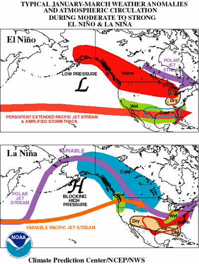
Nationwide, a weak El Nino pattern is brewing, U.S. meteorologists said.
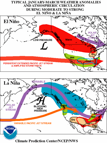
As a result of the pattern, the National Weather Service has predicted a warmer than normal winter for the northern and western three-quarters of the nation. The greatest chance for warmer than normal winter weather is in Alaska, the Pacific Northwest, Montana, northern Wyoming and western North Dakota.
No place in the country is expected to be colder than normal, said Mike Halpert, deputy director of the government’s Climate Prediction Center.
The Southeast, Ohio Valley and mid-Atlantic can go any which way on temperature, Halpert said.
Overall the winter looks a lot like the last few, Halpert said.
“The country as a whole has been quite mild since 2014-2015,” Halpert said.
Winter weather expert Judah Cohen, of the private company Atmospheric and Environmental Research, uses different indicators to predict winter for the National Science Foundation. He also forecasted a warm winter, heavily based on weak snowfall in Siberia.
Halpert said the southern one-third of the U.S. and much of the East Coast could be hunkering down for a wetter than normal December through January. The chances are highest in southeastern Georgia and much of northern and central Florida.
Hawaii, Montana, Michigan, parts of Idaho, Wisconsin, northern Illinois, Indiana and Ohio are forecast to be drier than normal, with the biggest likelihood in Hawaii, Montana and Michigan.
The middle belt of the nation and some of the north from California to New York can go any which way on precipitation.
The weather service’s forecast doesn’t look at snow likelihood.
Halpert said the biggest factor in the forecast is a likely El Nino , the natural warming of parts of the central Pacific Ocean that influences weather worldwide.
The El Nino hasn’t quite formed yet, but it’s almost warm enough. Meteorologists predict there’s a 75 percent chance it’ll be around this winter. But it will be weak, not strong like the El Nino that helped lead to the record warm 2015-2016 winter, Halpert said.
While El Nino is the biggest factor in the forecast, long-term warming from human-caused climate change is a factor, too, Halpert said.
“All things being equal, the slight kick we get out of the climate signal does tilt things toward the warm side,” Halpert said.
But it’s not enough to outweigh other factors if they push toward cold.
“Even on a warming planet,” he said, “it doesn’t mean winter goes away and it’s never cold again.”

(0) comments
Welcome to the discussion.
Log In