

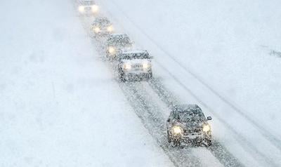

The National Weather Service has issued winter weather advisories for East Idaho calling for snow and 35 mph winds.
The winter storm is forecast to hit East Idaho starting late Monday morning and continuing through Tuesday morning. More snow is possible as the week progresses so check the local forecast for updates, especially if you plan to travel.
The winter weather is expected to make for hazardous driving conditions throughout the region and motorists should "slow down and use caution," the weather service said.
The storm is forecast to bring 3 to 8 inches of snow to the Spencer, Arbon, Malta, Rockland, Holbrook, Inkom, Arimo, McCammon, Downey, Lava Hot Springs, Emigration Summit, St. Charles, Montpelier, Paris, Georgetown, Grace, Soda Springs, Bancroft, Henry, Bone, Wayan, Swan Valley, Palisades, Victor, Ashton, Tetonia, Driggs and Island Park areas.
The weather service said 2 to 6 inches of snow could fall on the Dubois, Mud Lake, Idaho National Laboratory, Craters of the Moon, Idaho Falls, Ammon, Rexburg, Rigby, St. Anthony and Arco areas.
Several lowland areas including Pocatello, Chubbuck, American Falls, Aberdeen, Blackfoot, Fort Hall, Burley, Rupert, Raft River, Preston, Malad, Shelley and Firth are forecast to receive rain and snow from the storm with only an inch or two of snow accumulation at the most.
The storm could dump up to a foot of snow on East Idaho's higher mountaintops depending on its severity.
Elsewhere in the state, winter weather advisories are in effect in the central Idaho mountains including Stanley, Sun Valley, Ketchum, Hailey and Mackay as well as in southwest Idaho.
Winter weather warnings are also in effect in Nevada, Utah, Wyoming and Montana.
Stay with idahostatejournal.com for the latest forecast updates.

(0) comments
Welcome to the discussion.
Log In