

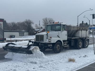

Winter storm warnings and winter weather advisories have been issued by the National Weather Service in anticipation of the latest in a series of snowstorms barreling through East Idaho.
The storm that's currently heading for East Idaho is forecast to arrive late Saturday night and continue through Monday morning, bringing several inches of snow to much of the region. The storm is the latest in a wave of winter weather systems that arrived in East Idaho on Thursday and will likely continue through this coming Friday.
The weather service said this about the incoming storm's severe impact on East Idaho's roads: "Travel could be very difficult to impossible. The hazardous conditions could impact the Monday morning commute. If you must travel, keep an extra flashlight, food and water in your vehicle in case of an emergency."
The areas hardest hit by the late Saturday night through Monday morning storm will likely be Bone, Ashton, Wayan, Swan Valley, Palisades, Driggs, Tetonia, Victor, Island Park and Emigration Summit. These areas could receive as much as 8 inches of snow from the storm.
Also hit hard will likely be St. Anthony, Idaho Falls, Ammon, Rigby and Rexburg, all of which could receive up to 6 inches of snow.
Up to 4 inches of snow could fall in the Downey, Soda Springs, Thatcher, McCammon, Arimo, Henry, Inkom, Lava Hot Springs, Arbon, Grace and Bancroft areas, while the rest of East Idaho including Pocatello, Chubbuck, Blackfoot, Atomic City, American Falls, Preston, Malad, Holbrook, Malta, Fort Hall, Montpelier, Paris, Georgetown, St. Charles, Aberdeen, Spencer, Dubois, Burley and Rupert could receive an inch or two of snow.
East Idaho's higher mountains could receive as much as 17 inches of snow from the incoming storm.
Elsewhere, winter storm warnings and winter weather advisories are in effect in North Idaho as well as in Montana, Wyoming, Utah, Oregon and Washington state because of the incoming storm.
Once this latest storm exits East Idaho on Monday morning, more snow is likely Monday afternoon and Monday night as additional storm systems pass through the region in a wintry barrage that will continue through Friday.
East Idaho's lowlands including its largest cities — Pocatello, Chubbuck, Blackfoot, Idaho Falls, Ammon and Rexburg — can expect up to an inch or two of snow every day Tuesday through Friday while the higher elevations could see up to 3 or 4 inches of snow some days.
Stay with idahostatejournal.com this week for the latest forecast updates.

(0) comments
Welcome to the discussion.
Log In