

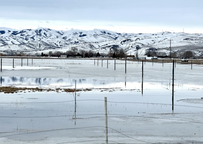
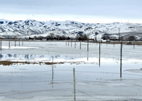
Snow, rain, destructive winds and flooding are in the forecast for East Idaho through Wednesday afternoon as a winter storm that arrived Tuesday morning continues to barrel through the region.
The National Weather Service has issued winter storm warnings, winter weather advisories, wind warnings and a flood advisory for East Idaho because of the storm.
Thunder and lightning are even possible in the region through Wednesday afternoon.
The storm is expected to be the first of several such weather systems to bring lower elevation rain and highland snow to East Idaho for the next few weeks as another atmospheric river hits California. The next storm is forecast to arrive in East Idaho this weekend.
The rising waters have already taken a toll on the Fort Hall Reservation, where several homes suffered flood damage on Tuesday.
The Shoshone-Bannock Tribes said they partially activated their emergency operations center in response to the flooding and are making sandbags available to reservation residents.
The Buffalo Lodge area of the reservation has been especially hard hit by the flooding.
Unlike previous storms to barrel through the region this winter, the current weather system is not ushering in Arctic-like temps. The result is that flooding is occurring in many areas of East Idaho because of the falling precipitation and snowmelt, according to the weather service. Several local counties are already offering sandbags to residents as the waters rise.
The weather service said the flooding is expected to be worst in the Idaho Falls, Ammon, Pocatello, Chubbuck, Rexburg, Rigby, Blackfoot, Fort Hall, Raft River, Burley, Rupert, Heyburn, Preston, Malad, McCammon, Arimo, Downey, Lava Hot Springs, Inkom, Malta, Aberdeen and American Falls Reservoir areas.
The weather service is advising motorists to stay away from flooded local roads.
"Turn around, don't drown when encountering flooded roads. Most flood deaths occur in vehicles," the weather service stated.
In addition to the flooding, East Idaho is expected to be hit by winds of up to 65 mph Tuesday night through Wednesday afternoon.
The tropical storm strength gusts will be strongest in the Burley, Rupert, Heyburn, Albion, Almo, Malta, Raft River, Rockland and Holbrook areas but the entire region can expect very windy conditions until the storm exits.
The weather service advised, "Secure or bring inside loose outdoor objects before the high winds begin. During the high winds, avoid being outside in forested areas or around trees, branches and power lines. Use caution if you must drive, and keep both hands firmly on the steering wheel. Drivers of high profile vehicles should consider delaying travel until the high winds subside."
Then there's the snow, which will continue to create hazardous conditions on higher elevation roads through Wednesday afternoon as well.
The storm is forecast to dump up to 8 inches of additional snow on the Island Park area Tuesday night through Wednesday afternoon, while the Victor, Emigration Summit, Swan Valley, Palisades and Wayan areas could see up to 5 or 6 inches of additional snow during that time frame and the Spencer and Dubois areas could receive up to 4 inches more.
The rest of East Idaho could receive an inch or two of snow Tuesday night through Wednesday afternoon along with more rain, especially in the lowlands.
East Idaho's higher mountains could receive as much as 20 inches of additional snow Tuesday night through Wednesday afternoon depending on the storm's severity.
Elsewhere in the state, winter storm and avalanche warnings are in effect in the central Idaho mountains including Stanley, Ketchum, Sun Valley and Hailey; wind warnings are in effect in south central and southwest Idaho; and winter weather advisories are in effect in North Idaho.
Most of Nevada is already under flood warnings because of the storm while winter storm warnings and winter weather advisories are in effect in Oregon, Washington state, Montana, Wyoming and Utah.

(0) comments
Welcome to the discussion.
Log In