

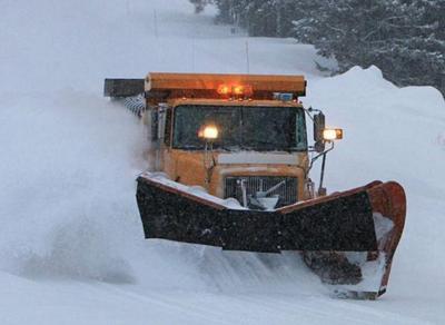
The National Weather Service has issued a winter storm warning and winter weather advisories for East Idaho's higher elevations in anticipation of a snowstorm that's expected to hit the region starting late Thursday morning.
The storm is forecast to continue through Friday night, making for hazardous roads in the higher elevations.
Driving conditions on Interstate 15 and Highways 20, 30, 31, 33, 36, 87 and 89 are expected to be especially difficult.
The weather service recommends keeping "an extra flashlight, food and water in your vehicle in case of an emergency."
East Idaho's mountains will be hardest hit by the snowstorm while lower elevation areas such as Pocatello, Chubbuck, American Falls, Blackfoot, Shelley, Firth, Aberdeen, Fort Hall, Malad, Preston, Idaho Falls, Ammon, Rexburg and Rigby are expected to receive a couple of inches of snow at the most.
The areas forecast to receive the most snow — up to 10 inches — are Driggs, Victor, Tetonia, Ashton, Swan Valley, Palisades, Wayan and Emigration Summit. It's even possible that the higher mountains in these areas could receive up to 16 inches of snow from the storm.
The storm could dump as much as 8 inches of snow on the Arbon, Inkom, McCammon, Arimo, Lava Hot Springs, Downey, Swanlake, Soda Springs, Grace, Bancroft, Henry, Bone, Montpelier, Georgetown, Paris, St. Charles and Malad Summit areas while up to 5 inches of snow could fall on the Island Park and Kilgore areas. The higher mountains in all of these areas could receive even more snow depending on the storm's severity.
The storm is also expected to bring winds of up to 40 mph to East Idaho, creating blowing and drifting snow that will likely make the region's higher elevation roads even more treacherous.
Once the Thursday-Friday storm exits East Idaho, another snowstorm is forecast to roll in on Saturday. The weather service is recommending that people pay attention to the weekend forecast to keep up to date on Saturday's expected snowy weather.
Elsewhere in Idaho, winter weather advisories calling for snow are in effect in the Stanley area as well as in parts of southwest Idaho and northern Idaho, where wind chill advisories are also in effect.
The incoming snowstorm has triggered winter storm warnings and winter weather advisories in Washington state, Oregon, Utah and Wyoming, special weather alerts in Nevada and wind chill warnings in Montana.
Stay with idahostatejournal.com for the latest weather forecast updates.

(0) comments
Welcome to the discussion.
Log In