

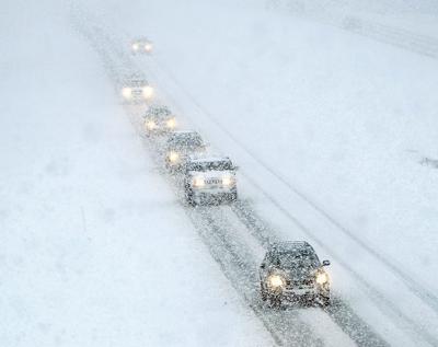
East Idaho is forecast to be hit Friday evening by the region's most significant snowstorm of the winter season thus far.
The storm is expected to continue through Saturday morning, creating potentially hazardous driving conditions throughout East Idaho.
The winter weather system is forecast to bring 1 to 4 inches of snow to East Idaho's lowlands with areas such as Pocatello, Chubbuck, American Falls, Aberdeen, Fort Hall, Blackfoot, Atomic City, Burley, Rupert, Raft River, Declo, Malta, Holbrook, Dubois, Shelley and Firth expected to be hardest hit.
The storm will likely dump 5 to 8 inches of snow on highland areas such as Inkom, McCammon, Arimo, Downey, Lava Hot Springs, Arbon, Rockland, Palisades, Spencer, Albion, Salmon and Emigration Summit. Other highland areas in East Idaho will probably only receive a couple of inches of snow.
A very similar storm is forecast to bring another round of snow to East Idaho's higher and lower elevations Sunday night through Monday night.
There's actually a chance of snow in East Idaho's highlands every day through next week but besides the two incoming storms accumulations are expected to be light.
No other winter weather warnings are in effect in Idaho but winter weather advisories are in effect in parts of Nevada, Utah, Wyoming and Montana and winter storm watches are in effect in parts of Oregon and Washington state.
Stay with idahostatejournal.com for the latest weather forecast updates.

(0) comments
Welcome to the discussion.
Log In