

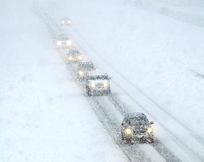
The National Weather Service has issued a winter storm warning and winter weather advisory for East Idaho in anticipation of a weekend snowstorm.
The storm could bring several inches of snow and 40 mph winds to most of East Idaho late Saturday morning through early Sunday afternoon.
"Travel could be very difficult due to blowing and drifting snow as well as low visibility," the weather service said. "If you must travel, keep an extra flashlight, food and water in your vehicle in case of an emergency."
The areas forecast to receive the most snow — 3 to 9 inches — are Mud Lake, Idaho National Laboratory, Craters of the Moon, Emigration Summit, Wayan, Swan Valley, Palisades, Arco, Victor and Island Park.
Between 2 and 6 inches of snow are expected to fall on the Idaho Falls, Ammon, Rigby, Rexburg, St. Anthony, Pocatello, Chubbuck, Blackfoot, American Falls, Aberdeen, Fort Hall, Malta, Arbon, Shelley, Firth, Rockland, Inkom, McCammon, Arimo, Downey, Lava Hot Springs, Malad, Holbrook, Preston, Montpelier, Paris, Georgetown, St. Charles, Soda Springs, Bancroft, Grace, Ashton, Tetonia, Driggs, Dubois, Henry, Bone, Thatcher and Spencer areas.
The rest of East Idaho including the Burley, Rupert, Raft River and Declo areas could receive an inch or two of snow from the storm.
East Idaho's higher mountains could receive up to 18 inches snow depending on the storm's severity.
Winter weather advisories and winter storm warnings are also in effect in the central Idaho mountains including Stanley, Ketchum, Sun Valley, Hailey, Mackay and Challis and winter weather advisories are in effect in south central Idaho.
Winter storm warnings and/or winter weather advisories are in effect in Oregon, Washington state, Nevada, Utah and Wyoming.
Stay with idahostatejournal.com for the latest weather forecast updates.


(0) comments
Welcome to the discussion.
Log In