



Hunters, anglers and other nonconsumptive outdoor enthusiasts all want state agencies to manage fish and game populations in a sustainable manner.
Like Goldilocks, state agencies seek a balance when determining how many animals can be harvested. If they allow too many animals to be reaped, future hunting and fishing options may be reduced. If too few animals are harvested, the agency unnecessarily reduces hunter and angler opportunities and likely loses revenue.
Determining proper regulations has always been difficult as they require merging public desires, animal numbers, habitat quality and weather. In the past, decisions were based on rough population estimates, a few surveys and purposive habitat evaluations. Although states would have liked to have done more, the cost of using agency personnel to conduct surveys limited the spatial scope and precision of evaluations.
Over the last decade it has become easier to collect and use digital data, web-based surveys and hunter collected information. State agencies have been slow to adopt and foster these digital and citizen gathered data efforts, but this is changing quickly.
The use of digital and analog data is new to many hunting and fishing situations, but the approach has long been part of setting waterfowl regulations. Since 1952, the Fish and Wildlife Service determined who was likely to hunt waterfowl by collecting names and addresses of individuals who bought duck stamps. This analog approach changed when the Harvest Information Program (HIP) was fully implemented in 1999.
The digital HIP survey not only collects names and addresses of waterfowl hunters, but whether they harvested no, a few or many ducks and geese the previous year. This information helps stratify sampling in a manner that improves estimates of waterfowl harvest. Aerial breeding grounds surveys of these birds combined with HIP related data have helped maintain North American waterfowl populations while allowing the annual harvest of more than 10 million ducks and three million geese.
Mandatory hunter reporting for big game harvest has been in place for hard to draw tags for the last 20 years in Idaho and Utah. Idaho started to require these reports for all big game tags in 2010. Utah implemented a similar requirement last year. These reports take hunters less than a couple minutes to complete and provide information that helps shapes state management and informs the hunter application process.
States are gaining better insight into habitat quality through the use of satellite data. These data allow for estimating vegetation type and site productivity state wide rather than for small representative areas. When these data are combined with evaluations of big game health, hunter success rates and precipitation they can provide insight into vegetative characteristics that produce more deer and elk and identify habitat restoration projects that work.
Digital data have helped conservation officers be more effective at finding and prosecuting poachers. Many poachers post pictures of their illegal exploits on-line. When citizens notice an improperly labeled picture, they often report these concerns. As digital photographs can contain metadata that include location and date, when this information doesn’t match the hunt unit or season described in the posting, these images provide evidence against illegal wildlife rustlers.
Recently Idaho has taken hunter surveys and data analysis to the next level in their evaluation of sage grouse harvest strategies. Although this species is at risk primarily due to habitat loss, it is important to document how hunting affects populations.
To do this, Idaho Fish and Game use multiple approaches. They survey the number of grouse that congregate on spring mating leks. These data feed into statistical models that construct an index of how many sage grouse will be present in the fall across 12 hunting zones. They then estimate the number of tags that can be sold given average hunter success rates and an intent to harvest 5% of the population.
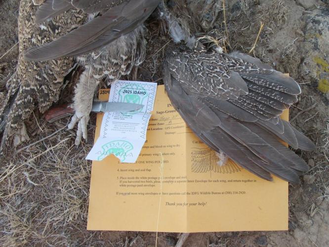
Hunters who purchase tags are identified and sent envelopes so they can provide a wing to determine a harvested bird’s age and sex — information necessary for the statistical model. The approximately 5,000 individual bird tags are sold to residents for $22.75 and non-residents for $74.25 and help cover the cost of the program.
Digital and hunter provided data are helping state and federal fish and wildlife agencies meet their mandate to sustainably manage fish and wildlife. These approaches will gain importance as the cost of on-the-ground monitoring efforts increase. Determining how to collect cost effective data is an important question facing agencies. Those decisions will be made easier if hunters and anglers are willing to continue to provide high quality information from their experiences and the cost of digital data declines.


(0) comments
Welcome to the discussion.
Log In