

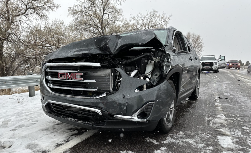

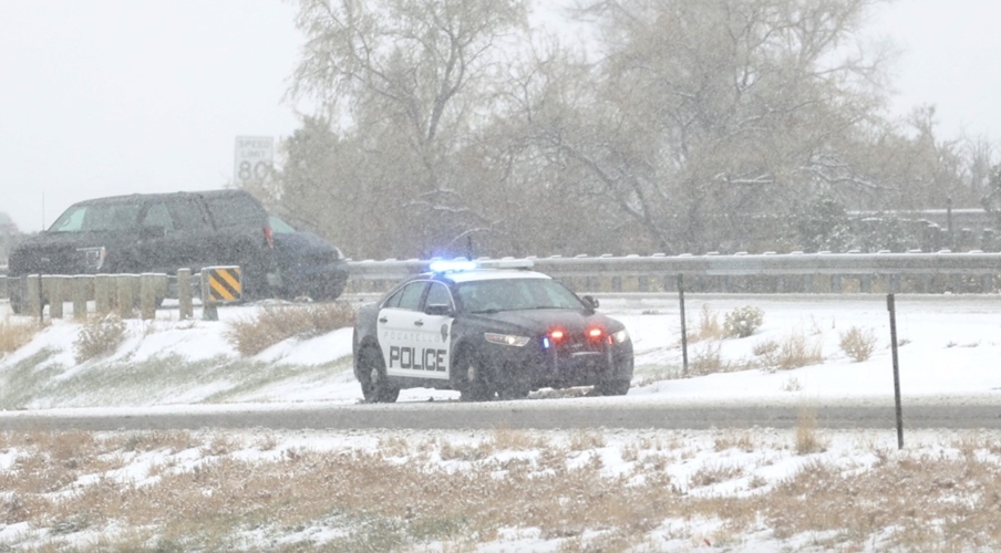
The first of two winter storms forecast to hit East Idaho this weekend caused numerous wrecks on Saturday on Interstate 15.
One of the crashes shut down the freeway's northbound lanes in south Pocatello for over an hour but did not result in any injuries.
The crash occurred around 11:20 a.m. Saturday when a northbound 2019 Kenworth semi driven by a 24-year-old man from Franklin was passing a previous crash on Interstate 15 and was rear-ended by a 2020 GMC Terrain driven by a 21-year-old woman from Spring Hill, Florida, who had a 26-year-old woman from Rexburg as her passenger, Idaho State Police said.
Authorities said the driver of the GMC Terrain lost control in the snowy conditions near Interstate 15's South Fifth Avenue exit and struck the semi.
All of those involved in the crash were wearing seat belts and none required transport to the hospital, state police said.
The wreck shut down Interstate 15's northbound lanes in south Pocatello for about 90 minutes, authorities said.
It was one of many Saturday morning and afternoon crashes on a snow-covered Interstate 15 in Southeast Idaho, with most of the accidents occurring in the Shelley, Blackfoot, Pocatello and Inkom areas.
Some of the crashes resulted in injuries but thus far there have been no fatalities, state police said.
Local road conditions are expected to worsen before they get better this weekend as two winter storms are forecast to barrel through East Idaho.
The first storm arrived in East Idaho on Saturday morning and is expected to bring up to 2 inches of snow to the region through Saturday night, the National Weather Service reported.
The second storm is forecast to be the stronger of the two and will hit East Idaho late Sunday morning through Tuesday morning.
The weather service has issued a winter storm watch for East Idaho in anticipation of the second storm.
The weather service stated about the second storm's impact: "Travel could be very difficult. The hazardous conditions could impact the morning or evening commute. The combination of wind in excess of 15 mph and snowfall can mean heavy drifting of the new snow and a sudden change to near zero visibility for motorists. The cold wind chills as low as 15 below zero could result in hypothermia if precautions are not taken."
This late Sunday morning through Tuesday morning storm is forecast to bring up to 3 or 4 inches of snow to East Idaho's lower elevations including Pocatello, Chubbuck, Idaho Falls, Ammon, Blackfoot and Rexburg and several inches to the region's highlands.
Up to 10 or 11 inches of snow could fall on many of East Idaho's higher elevations including the Emigration Summit, Island Park, Ashton, Wayan, Swan Valley, Palisades, Victor, Tetonia and Driggs areas. The higher peaks in those areas could receive over a foot of snow depending on the second storm's severity.
The second storm will also bring winds of up to 35 mph to East Idaho, making driving conditions even more hazardous.
The weather service said people who need to travel home following the Thanksgiving holiday should consider leaving sooner rather than later because of the storms or to wait out the storms and head home on Tuesday afternoon.
This is especially true for people who are heading east into Wyoming, where conditions are expected to be worse than East Idaho, the weather service said.
After the storms pass through East Idaho, the region will likely see clear conditions Tuesday afternoon through Wednesday before more winter storms arrive Thursday through next weekend bringing more precipitation in the form of rain and snow to the region.
The storms hitting the state this weekend have already resulted in winter storm warnings and winter weather advisories in North Idaho, winter storm watches in southwest Idaho and a winter weather advisory for the Salmon area.
Various winter weather warnings are also in effect in Oregon, Washington state, Montana, Wyoming and Utah.
Stay with idahostatejournal.com for the latest forecast updates.

(0) comments
Welcome to the discussion.
Log In