

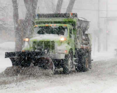

Another winter storm is forecast to hit East Idaho starting Sunday morning.
The National Weather Service has issued a special weather alert and winter weather advisories for East Idaho warning the public about the incoming storm that will arrive Sunday morning and continue bringing snow to the region well into Monday morning.
The Island Park, Victor and Emigration Summit areas are expected to be hardest hit by the storm and are forecast to receive up to 6 inches of snow.
The weather service said the storm is expected to bring 1 to 4 inches of snow to the rest of East Idaho, including lower elevation areas.
The weather service said road conditions could be especially icy on Sunday morning in the Pocatello, Chubbuck, American Falls, Aberdeen, Fort Hall, Burley, Rupert, Raft River, Declo, Blackfoot, Firth, Shelley, Rockland, Arbon, Malta, Albion, Almo, Holbrook, Inkom, McCammon, Arimo and Downey areas. The storm could bring a mix of snow, sleet and freezing rain to those areas, resulting in a dangerous glaze of ice on the roads.
The weather service said regardless of how much snow falls, motorists should expect difficult driving conditions throughout East Idaho Sunday morning through Monday morning, especially in the higher elevations.
"While forecast snow totals with this system are modest and much lower compared to the recent winter storm this past week, remember that it doesn't take much snow to make roads slick," the weather service stated. "Slow down and allow extra time to reach your destination."
The storm is the latest to hit East Idaho after the region received several inches of snow this past week, causing numerous wrecks and several road closures.
The incoming storm has triggered winter weather warnings in most of Idaho as well as in all surrounding states.
Stay with idahostatejournal.com for the latest forecast updates.


(0) comments
Welcome to the discussion.
Log In