

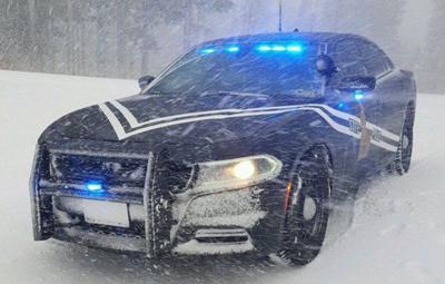

Idaho State Police are urging motorists to use caution because of the winter storm that's currently hitting East Idaho.
State police reported that conditions are particularly hazardous on Highway 20 in the Island Park area where several snow-related crashes occurred Sunday morning. Further details on those wrecks have not yet been released.
The National Weather Service says conditions in East Idaho for the next few days will include rain, snow and below-freezing temperatures because of the storm.
There’s also the threat of flooding and mud and rock slides.
But compared to the forecast for much of the rest of Idaho as well as surrounding states, East Idaho is not going to experience anything resembling the worst from the major winter storm that began dropping rain on local areas Saturday morning.
Still, the National Weather Service has issued a winter weather advisory, flood watch and freeze warning for East Idaho in response to the unusual early autumn winter storm.
East Idaho’s higher elevations could receive up to four inches of snow from the storm while the lower elevations including the Pocatello, Chubbuck, Blackfoot, Idaho Falls, Ammon and Rexburg areas could receive up to an inch. The greatest chances for snow in East Idaho are Saturday night through Sunday night, with a much lower chance on Monday.
The storm is bringing rain to East Idaho and lots of it. Two inches of rain could fall on East Idaho and this could cause flooding and mud and rock slides, the weather service said. The rain that began Saturday morning in East Idaho will continue through Sunday and could linger into Monday.
Last but not least, the storm is sending the mercury plummeting in East Idaho. Daytime highs Sunday through Tuesday are forecast to be in the 40s and low 50s. Nighttime and morning lows Sunday morning through Wednesday morning are expected to be in the 20s and low 30s. That will be cold enough to provide a hard freeze that will end the growing season in East Idaho, the weather service said.
The weather service has issued a freeze warning for East Idaho to alert the public about the very cold temperatures. Conditions will be cold enough to damage any plumbing that is exposed to the elements, the weather service said.
Elsewhere in Idaho and in surrounding states, the storm is forecast to have an even greater impact.
AccuWeather is calling the storm “historic” for its early season timing and expected ferocity.
Anyone considering traveling in the backcountry of Montana, Idaho, Wyoming and/or Washington state during the storm needs to realize that they will face life-threatening conditions, AccuWeather warned.
The storm will bring winds of up to 50 mph to those states and downed tree limbs and power outages are likely, AccuWeather said.
Winter storm warnings have been declared for North Idaho where over a foot of snow could fall and the central Idaho mountains are under winter storm warnings and winter weather advisories calling for several inches of snow from the storm.
Montana could receive a record-breaking amount of snow from the storm for this time of year. Most of Montana is under winter storm warnings, winter storm watches and winter weather advisories and many areas of the state could receive over two feet of snow.
Wyoming is also expecting to be hit hard by the storm. Winter weather advisories calling for several inches to over a foot of snow have been declared for western Wyoming and most of the rest of the state is under a hazardous weather alert calling for snow and rain.
Much of Washington state is under winter storm warnings and winter weather advisories calling for a foot or more of snow.
Winter weather advisories calling for several inches of snow are in effect in northern Oregon and several winter storm alerts and high wind warnings are in effect in Nevada and Utah because of the storm.

